Land·Reference entry
The 1968 Act and the Peaks It Enclosed

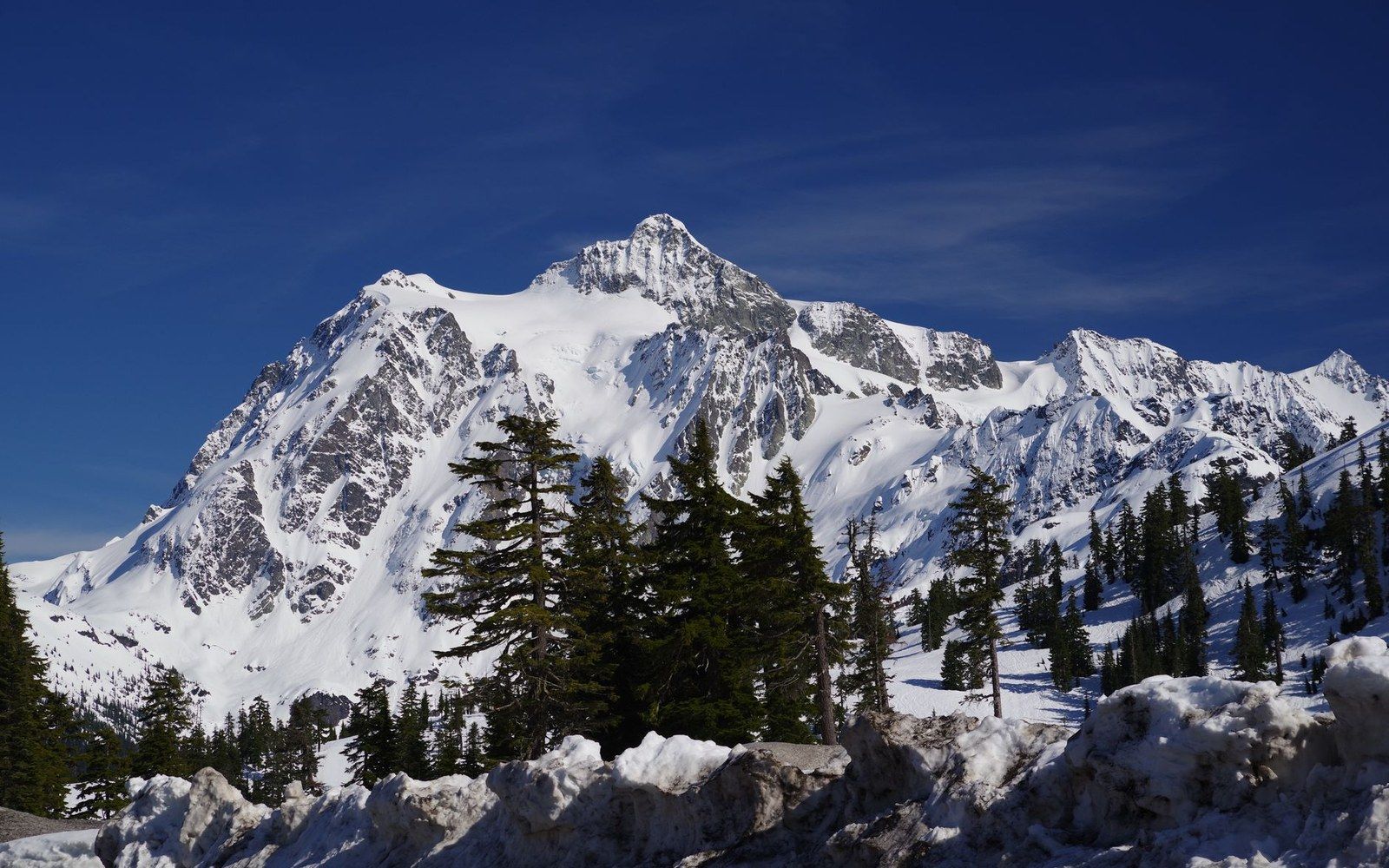
Photo: Exotic Terranes—North Cascades near Ross Lake · Wikimedia Commons
How a Boundary Became Part of the Record
Congress established North Cascades National Park ↗ on October 2, 1968, drawing a line around roughly 504,000 acres of the northern Washington Cascades. The legislation created not one administrative unit but three: North Cascades National Park itself, split into a north and south unit, and two flanking national recreation areas — Ross Lake and Lake Chelan — managed under different rules by the same agency. The National Park Service replaced the U.S. Forest Service as the governing authority across most of the terrain that serious climbers had been entering for decades.
The peaks enclosed by that boundary include some of the range's most consequential climbing ground. Forbidden Peak, at 8,815 feet, fell within the park's south unit. The Picket Range, whose remote towers had drawn small parties since the 1930s, lay in the park's north unit. Mount Shuksan, at 9,131 feet and built from metamorphic rock unlike anything else in the range, sat just inside the new boundary's northwestern reach. The act did not create these climbs, but it determined who would administer them and under what terms — a distinction that matters for the documentary record.
Before 1968, first-ascent parties in this terrain logged their climbs largely through the Washington Alpine Club, The Mountaineers, and Fred Beckey's meticulous notebooks, which eventually became the Cascade Alpine Guide series published by The Mountaineers Books. The park designation introduced National Park Service ↗ permitting frameworks, backcountry registration, and agency oversight — institutional layers that altered how activity in the range was recorded and by whom. Routes that had existed only in club journals and Beckey's files now intersected with federal administrative systems.
The 1968 act also fixed the boundary against future Forest Service timber and mining activity, which had been the primary land-use pressure in the northern range before designation. For climbing access specifically, the shift was more procedural than physical: the rock did not move, but the authority over it did. Parties approaching the Pickets or the peaks above the Cascade River drainage would now register with a different agency, one whose mandate centered on preservation rather than multiple use.
The boundary drawn in 1968 remains the governing line. Named routes inside the park — on Forbidden, on Shuksan, on the Picket towers — carry that administrative address as part of their identity in the historical record, whether or not the climbers who first ascended them anticipated any such thing.
Key facts from the act
- Date signed: October 2, 1968
- Total area enclosed: roughly 504,000 acres
- Administrative structure: North Cascades National Park (north and south units) plus Ross Lake and Lake Chelan National Recreation Areas
- Administering agency: National Park Service, succeeding the U.S. Forest Service
The peaks enclosed by that boundary include some of the range's most consequential climbing ground.
Notable peaks enclosed
- Forbidden Peak — 8,815 ft, south unit
- Mount Shuksan — 9,131 ft, metamorphic, northwestern boundary
- Picket Range — remote tower cluster, north unit