Peaks & Routes·Reference entry
Four Towers Above the Highway, and the Line Beckey Found in 1946
Liberty Bell Mountain stands at 7,720 feet above the Methow Valley, a four-sided tower of granodiorite at Washington Pass that is readable from the highway in a way that almost no other Washington peak is. The north face was first climbed in August 1946. Fred Beckey was twenty-three years old.
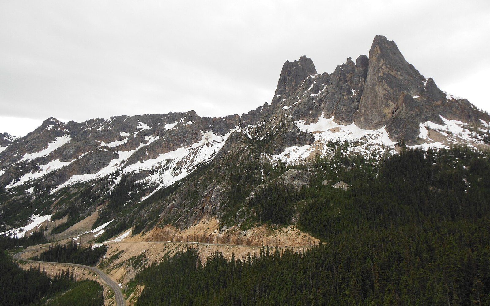
Photo: Washington Pass and Liberty Bell Mountain · Wikimedia Commons
What Was Known Before the Ascent
Washington Pass sits at 5,477 feet on the North Cascades Highway, the route now designated State Route 20, which did not open as a continuous road corridor until 1972. In 1946, the pass was accessible only by trail and rough track, and the peaks above it — Liberty Bell and the Early Winters Spires immediately to the northwest — were among the least-visited technical terrain in Washington. The Mountaineers had been cataloguing Cascade summits since their founding in 1906, but the upper Methow peaks lagged well behind the Index, Leavenworth, and Rainier zones in documentation.
Liberty Bell had been observed and named before anyone reached its summit. The name appears in Forest Service correspondence and survey material from the early twentieth century, assigned for the bell-tower profile the peak presents from the west — a clean vertical silhouette that distinguishes it from the broader ridgelines on either side. The Washington Alpine Club had members active in the North Cascades during the 1930s and early 1940s, and the peak was known as a technical objective that had not been completed. Its four principal ridgelines converge at a summit block requiring genuine rock climbing to reach; no snow approach leads there without a technical finish. That combination — the profile, the difficulty, the isolation — left Liberty Bell as an obvious open problem in the regional record.
The rock is granodiorite, part of the Golden Horn batholith, an intrusive body of Eocene age. The Columbia River Basalt Group that dominates eastern Washington stops well to the south; here the geology is older, coarser, and more complex. The Golden Horn granodiorite tends toward steep jointing and clean crack systems — features that would matter to any climbing party assessing lines on the northeast buttress.
Chronology
- Pre-1906Liberty Bell named in Forest Service correspondence for its bell-tower profile; no climbing record
- 1906The Mountaineers founded in Seattle; begin systematic Cascade documentation
- 1942Fred Beckey and Helmy Beckey complete second ascent of Mount Waddington, B.C.
- August 1946Fred Beckey's party completes first ascent of Liberty Bell via northeast buttress
- 1968North Cascades National Park established; Liberty Bell remains in Okanogan-Wenatchee National Forest
- 1972State Route 20 completed; Washington Pass overlook makes Liberty Bell visible to highway traffic
The 1946 Ascent
Fred Beckey completed the first ascent of Liberty Bell Mountain in August 1946, approaching via the northeast buttress with a small party. The route gained the summit by way of the prominent ridge system visible from the approach — a sustained rock climb at an elevation where afternoon weather in the North Cascades can change character quickly. Beckey was already an established figure in Washington climbing by this point; he and his brother Helmy had completed the second ascent of Mount Waddington in British Columbia in 1942, a climb that announced him as a technical mountaineer of unusual range and persistence.
The northeast buttress of Liberty Bell follows crack systems and face features on granodiorite that holds gear placement well in its cleaner sections. The route ascends several hundred feet of genuine rock to a summit that offers no easy alternative. As a first ascent, the 1946 climb stood for years as the only documented route on the peak — subsequent routes were added over the following decades, but the Beckey line on the northeast buttress remained the reference climb. The U.S. Geological Survey's peak record for Liberty Bell gives the elevation as 7,720 feet, consistent with the figure carried in Beckey's own Cascade Alpine Guide, his three-volume reference work that became the primary documentary record of Washington climbing routes through the latter half of the twentieth century.
What Beckey's party found at the summit in 1946 was, in the literal sense, an unrecorded place. No register had been left, no cairn built by a prior party. The northeast buttress, as a named line, dates from this ascent; the summit itself acquires its climbing record here. The peak had existed in Forest Service nomenclature for decades, but the climbing record begins in August 1946.
Key figures and formations
- Fred Beckey — first-ascensionist, northeast buttress, August 1946; author of Cascade Alpine Guide
- Golden Horn batholith — Eocene granodiorite intrusion forming Liberty Bell and surrounding peaks
- Northeast buttress — the named line of the first ascent; the route's foundational record
- Washington Pass overlook — the point from which Liberty Bell's west face became widely visible after 1972
The Peak in the Larger Record
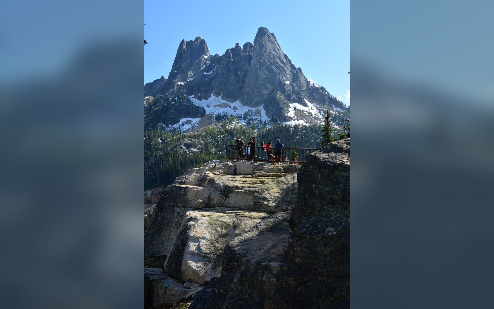
Liberty Bell is one of a cluster of spires at Washington Pass that together form one of the most photographed ridgelines in the North Cascades. The Early Winters Spires and Lexington Tower, Liberty Bell's neighbors to the northwest, and the southern faces above Copper Creek Basin give the pass an alpine density unusual even for the North Cascades. When State Route 20 was finally completed in 1972, the overlook at Washington Pass gave drivers a direct view of Liberty Bell's west face, and the peak entered a much wider popular awareness than any approach trail had allowed.
North Cascades National Park, established by the 1968 act, enclosed much of the terrain to the north and west of Washington Pass, but Liberty Bell itself sits just outside the park boundary in the Okanogan-Wenatchee National Forest, administered by the U.S. Forest Service ↗. That jurisdictional position has shaped how the peak has been managed and documented, keeping it within the Forest Service's climbing-management framework rather than the Park Service's. The distinction matters less on the rock than it does on paper, but the paper trail — permits, surveys, the named feature in the Geographic Names Information System — runs through the Forest Service record.
Beckey returned to Washington Pass terrain across his career, adding routes on adjacent formations and continuing to document the range in the Cascade Alpine Guide volumes published by The Mountaineers Books. His 1946 ascent of Liberty Bell was one among several hundred documented first ascents he would eventually accumulate, but it belongs to a specific and important category: a peak with genuine profile and regional significance, unclimbed until he reached it, and carrying no prior technical record. The northeast buttress route is the datum from which every subsequent ascent of the peak is measured.
Liberty Bell had been observed and named before anyone reached its summit.
The four towers visible from the highway overlook — Liberty Bell and the Early Winters Spires — collectively represent the most immediately legible alpine rock in the state to anyone driving SR 20 in summer. Liberty Bell's summit, at 7,720 feet, is not the highest of them; South Early Winters Spire stands taller. The line Beckey identified and climbed in August 1946, when the highway did not exist and the approach required real commitment, is still the peak's foundational route. The record starts there.