Darrington·Reference entry
Three O'Clock Rock and the Sauk's Afternoon Light
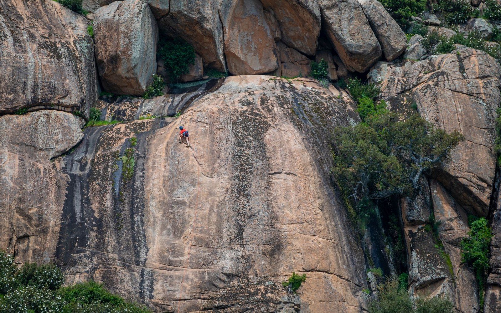
Photo: Osviel Rodriguez Valdés / Pexels
The name and the place it marks
Three O'Clock Rock sits above the Sauk River drainage southeast of Darrington, Washington, its name recording something literal and exact: the hour at which afternoon sun reaches the slab face and makes it worth climbing. That kind of naming — functional, clock-calibrated, stripped of romance — belongs to the working vocabulary of climbers who arrived early, waited out the morning shade, and learned the crag by its habits. The name is not on a Forest Service survey. It belongs to the record of the rock.
Darrington occupies the western Cascades at the point where the Sauk River ↗ curves north toward its confluence with the Skagit. The town sits inside a band of geology dominated by plutonic intrusions — the Darrington pluton and the granitic masses associated with it — that surface as clean, jointed rock wherever glaciation and erosion have stripped the forest cover. Three O'Clock Rock is one of those surfaces: a slab formation rather than a wall, tilted toward the southwest and polished to a friction climber's argument about angle and adhesion.
Chronology of context
- 1930s–40sExpeditionary focus on Picket Range, Glacier Peak, and North Cascades high peaks
- Postwar–1960sSeattle-area climbers expand the regional record toward smaller crags including the Darrington highlands
- 1960s–70sYosemite-influenced slab technique enters Pacific Northwest climbing vocabulary; friction crags like Three O'Clock Rock catalogued
Geology distinct from the canyon crags
The distinction matters. Washington's better-known climbing areas west of the Cascades crest tend toward near-vertical crack systems — the Index Town Walls, formed from the Index batholith, are the measure of that form. Three O'Clock Rock operates on a different principle. Its face is low-angle to moderate, the kind of terrain where the challenge is sustained slab technique across long stretches of featureless granite rather than a sequence of discrete holds in a crack. The rock belongs to the same general family of intrusive igneous material that underlies the Darrington highlands, mineralogically coarse and rough enough at small scale to reward smearing even where the angle eases.
Exfoliation Dome, several miles away near Darrington, is the region's most discussed example of how pressure release peels sheets from a granite body and leaves a curved, holdless surface. Three O'Clock Rock is not an exfoliation dome in that strict sense, but it shares the broad character of the slab landscape: routes are defined by natural features — seams, edges, ripples — rather than by hand-crack systems. That geological fact shaped which climbers were drawn here and what they put up.
The first-ascent record
The Darrington area entered the serious climbing record later than the major ranges. The Picket Range, Glacier Peak, and the peaks of the North Cascades ↗ drew expeditionary attention through the 1930s and 1940s; smaller crags near Darrington were catalogued more slowly, as the postwar generation of Seattle-area climbers — organized in part through The Mountaineers and later through informal partnerships of the 1960s and 1970s — expanded the regional record outward from the Leavenworth and Index corridors. Three O'Clock Rock was explored during that expansion, its routes recorded without the fanfare that attached to a named Cascade summit but with the same documentary precision: a party, a date, a line.
The slab format attracted climbers interested in friction climbing at a time when Yosemite-influenced technique was entering the Pacific Northwest vocabulary. Routes on Three O'Clock Rock follow the grain of the rock rather than fighting it, and the grades reflect that: sustained rather than crux-dependent, long rather than gymnastic. Fred Beckey, whose decades of first ascents across Washington constituted an essentially personal survey of the state's climbable rock, touched the Darrington area repeatedly; the broader regional record that bears his systematic stamp includes formations of exactly this character — moderate-angle granite slabs logged as part of an ongoing inventory rather than as singular prizes.
Formation character
- Type — slab formation, not a wall; low-angle to moderate face
- Rock — coarse-grained granitic intrusion, Darrington pluton family
- Orientation — southwest-facing; direct sun arrives mid-afternoon, hence the name
- Style — sustained friction climbing over long stretches, routes defined by seams and edges rather than crack systems
Afternoon light as a condition of the record
The naming of Three O'Clock Rock is, in the end, a document about access rather than aesthetics. A slab formation that faces southwest dries late and catches friction-favorable sun in a valley where the forest is dense and mornings are frequently wet. Climbers named the rock for when it was climbable. That is the kind of knowledge that accumulates over seasons, not expeditions — the knowledge of people who returned, who learned the drainage's rhythm, and who encoded what they learned in the only permanent medium available to them: the name on the route, the name on the rock.
Darrington occupies the western Cascades at the point where the Sauk River ↗) curves north toward its confluence with the Skagit.