Enchantments·Reference entry
The 1976 Line That Changed the Enchantments
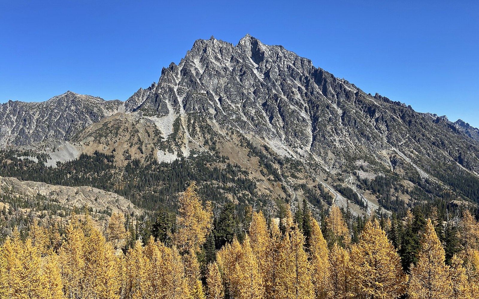
Photo: Ingalls Pass at Alpine Lakes Wilderness in Washington 26 · Wikimedia Commons
A Law as a Geographical Event
On July 12, 1976, Congress passed the Alpine Lakes Wilderness Act ↗, designating 393,000 acres of the central Cascades as federal wilderness under the Wilderness Act of 1964. The boundary it drew enclosed the Enchantments basin — the high granite cirque above Leavenworth drained by Icicle Creek — and in doing so converted a heavily used backcountry area into a managed wilderness administered by the U.S. Forest Service. That conversion is a geographical event as much as a legislative one: it fixed the basin's outer edge on paper, assigned an authority, and eventually produced the permit system that has governed access ever since.
The Enchantments had been climbed since at least the early twentieth century, and the first-ascent record across the basin's peaks accumulated steadily through the mid-century decades. Prusik Peak, which carries the name of Austrian mountaineer Karl Prusik through the knot he devised, drew particular attention. The granite of the Stuart batholith — the coarse intrusion underlying both the Enchantments and the broader Stuart Range to the west — provided the rock that made the basin worth the approach. Before 1976, the agency context governing that rock was looser: the land sat within the Wenatchee National Forest, but no wilderness overlay imposed the restrictions that the 1964 Wilderness Act authorizes.
Chronology
- 1906The Mountaineers founded in Seattle
- 1964Wilderness Act passed; establishes the legal framework the 1976 act invokes
- July 12, 1976Alpine Lakes Wilderness Act signed; 393,000 acres designated
- 1976 onwardU.S. Forest Service assumes wilderness management authority over the Enchantments basin
What the Boundary Drew
The Alpine Lakes Wilderness Act did not create the Alpine Lakes region as a climbing area. Routes existed, parties had been there for decades, and the Enchantments' reputation was already established among Pacific Northwest climbers. What the act did was draw a statutory line around it. Within that line, motorized equipment was prohibited, new structures were barred, and the character of the place was formally defined as one to be preserved. The U.S. Forest Service became the managing authority with an explicit mandate — not simply to permit access, but to protect the wilderness character the act named.
For the climbing record, the practical consequence emerged gradually. The Mountaineers, founded in Seattle in 1906, had long documented the range through their publications and outings programs; Fred Beckey's Cascade Alpine Guide provided the route record that defined what the designated land contained. The 1976 act did not alter any of those first-ascent credits or route names. What it altered was the administrative envelope around them: the same pitches and summits now sat inside a designated wilderness with statutory standing, and any future management decisions — including limits on overnight visitors — would be made under that framework.
The permit lottery that the Forest Service eventually established for overnight use in the Enchantments core zone is the most visible consequence of the 1976 designation. The act itself did not mandate a lottery; it mandated wilderness character, and the lottery followed from the Forest Service's obligation to protect it against overuse. The Alpine Lakes Wilderness ↗ now covers land administered across portions of the Okanogan-Wenatchee and Mount Baker-Snoqualmie National Forests, with the Enchantments sitting in the southern Wenatchee portion of the unit.
Key boundary facts
- Designated area: 393,000 acres
- Administering agency: U.S. Forest Service (Okanogan-Wenatchee and Mount Baker-Snoqualmie National Forests)
- Rock type: Stuart batholith granite (same intrusion as the Stuart Range)
- Terrain enclosed: Enchantments basin, Prusik Peak, upper Icicle Creek drainage
- Terrain excluded: Snow Creek Wall, lower Icicle Creek, Peshastin drainages
The Record Inside the Line
The act's boundary is also, incidentally, a record of what Congress in 1976 judged worth protecting. That judgment enclosed Prusik Peak, the upper Enchantments lakes, and the granite above Stuart Lake. It excluded, by the placement of the line, other terrain — the lower Icicle Creek drainage, the Snow Creek Wall to the north, and the Peshastin drainages to the east remained outside the wilderness boundary. Those distinctions matter to the climbing record because they determined which land would be managed under the stricter standards and which would remain subject to ordinary Forest Service multiple-use policy.
The 1976 act is not remembered as a climbing document. It is remembered, if at all, as environmental legislation. But geography does not distinguish between sources. The line it drew is the line that makes the Enchantments basin a defined place in the administrative record — and any account of climbing there that does not acknowledge the 1976 boundary is missing the frame around the picture.
The Enchantments had been climbed since at least the early twentieth century, and the first-ascent record across the basin's peaks accumulated steadily through the mid-century decades.